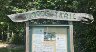
North Mountain Trail to Pete’s Cave
This is an out-and-back hike following the ridgeline of the North Mountain that forms the boundary between Rockbridge and Alleghany Counties in Virginia. This hike contains an abundance of overlooks, many of which look east toward Big and Little House Mountains, the town of Lexington, and the Blue Ridge Mountains near Buena Vista, Virginia. It also passes through a stand of nearly 200-year-old white oaks. Eventually, it arrives at Pete’s Cave.
Description
W & L’s Outing Club published a guidebook some years ago that proclaimed the North Mountain Trail, “Undoubtedly, this is Rockbridge County’s finest trail!” Anyone who has hiked it would be hard pressed to argue.
It is possible to start hiking the North Mountain Trail from its western end at the George Washington National Forest’s Longdale Recreation Area, but most folks drive up to the ridge line using Route 770, start from the east, and only hike the best part of the trail.
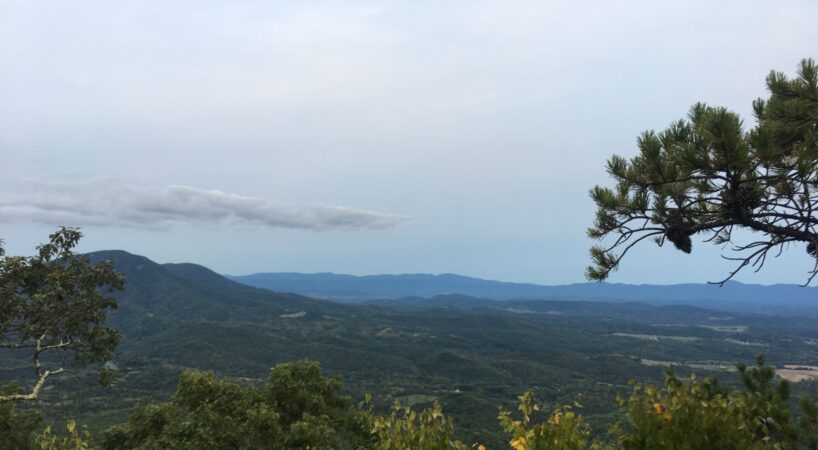
The trail begins near a parking spot at the top of North Mountain. At the parking area, cross FDR 700 to the boulders. The elevation is 2971 feet. The trail passes between these boulders. For the first ten minutes, the trail travels across the top of a long cliff face. Several short turns off to the right lead through the dense understory to the cliff top. The view of Lake Robertson, House Mountain, and the Blue Ridge is fantastic. The canopy on this rugged mountain top is low and consists mainly of pine. The understory is blueberry, huckleberry, Mountain laurel, and rhododendron.
After 0.5 mile,s the trail bends away from the rocks and descends at an easy grade to a saddle. This area can be weedy in the summertime, so beware of the Stinging nettle and ticks. There is an old sign that says “Trail”. From here, the trail bends left and starts a moderate climb. The forest is now dominated by small Tulip poplars and hickory.
As the climb levels out, the trail bends right and then snakes to the left. The forest is mainly old-growth White oak. The elevation is just over 3100 feet. The trail passes across a rounded, well-shaded ridge crest and through some large boulders. For the next mile, the trail continues across the ridge top. The grade is a series of easy ups and downs with a few lazy turns to the right and left. There are a few blazes, but the trail is easy to follow. The elevation is just over 3200 feet.
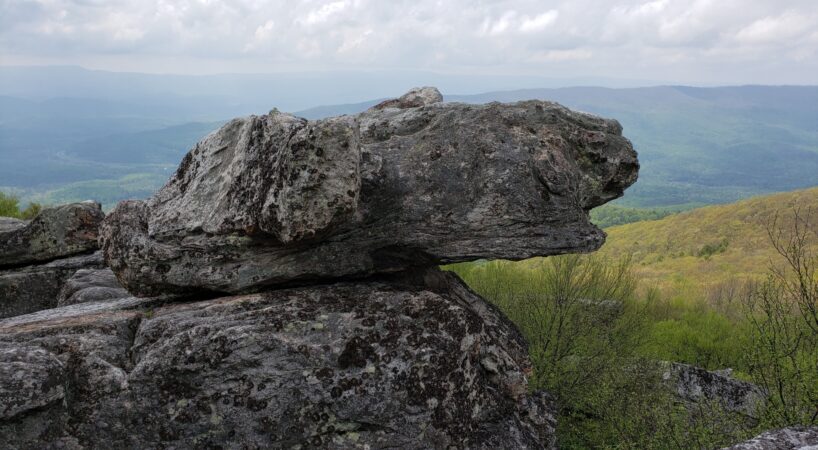
At about 3.0 miles, the trail makes a short but difficult climb. At the top of this climb, there is another outcropping of rock. The trail passes left of these rocks and begins an easy downhill. It is difficult to find an easy route to the top of the rocks to the right, but taking the time to do so is rewarding. There is a beautiful view of Alleghany County, and there is almost always a cooling breeze blowing.
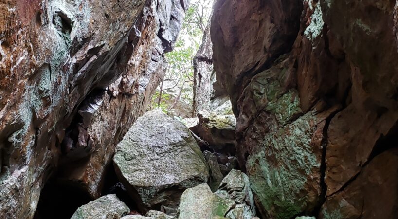
After passing the rocks, the trail travels through a forested area with an almost park-like feel to it. Weeds are non-existent at this point. At 3.5 miles the trail reaches the second large set of rocks. This area is especially interesting as the trail makes it way right up through the middle of the outcropping. The air is cool as the trail winds between the boulders. The climb this crevasse is steep. At the end of the climb there is a wonderful reward.
The area is commonly called Pete's Cave, named for a cave that can be found among the rocks.
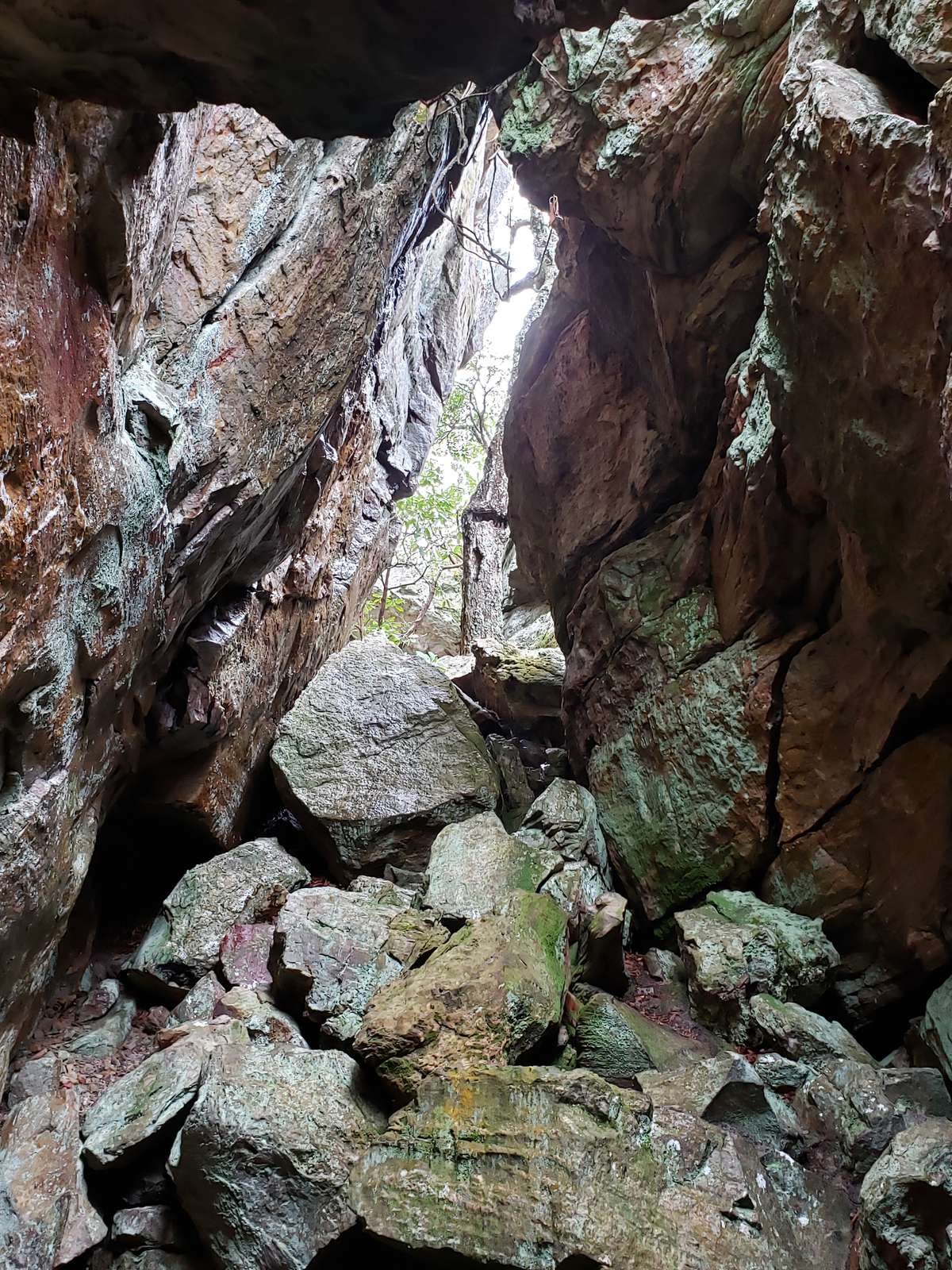
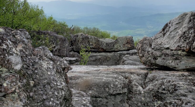
After exploring the lower side of the rocks, hike the trail to the top. The top is characterized by a large flat top of rocks with narrow one-to-four-foot crevasses that drop off as much as twenty feet to the lower area you just explored. The flat rocks on the top have a wide-open view and are a great place to rest and have a snack. From this vantage point, House Mountain, Hogback Mountain, The Peaks of Otter, and Warm Springs Mountain are visible.
Driving Directions
Turn right on East Washington Street. Proceed 0.4 miles to West Nelson Street and turn right. Continue 5.8 miles and turn right on US 60 (Fredericksburg Road). There is a sign of I-64 at this turn. Proceed 0.4 miles and turn left on I-64 west. Once on I-64 take exit #43. Turn left on Scenic Drive at the stop sign. Proceed 6.7 miles on a gravel road to the crest of the mountain. There is a parking area on the left side of the road.
Tips
- Cocks Comb hike is really close to North Mountain Trail and is a wonderful sunset hike, so if you have the time you could watch the sunset from Cocks Comb while you are up there! This is a well-known mountain biking trail. Be sure to keep an eye out for riders on this trail on weekends.
Insider's Tips
- You should definitely plan on taking a picnic with you, there are so many amazing overlooks to enjoy a picnic at! You could order lunch to go from our famous “Sweet Treats Bakery” in Lexington before you head out.
- If you want to settle down for the night under the stars, Lake Roberstons' campground is very close, and also a great spot for casual fishing and grilling.