Saint Mary's Wilderness
This scenic hike follows a river through stunning rock formations, leading to a breathtaking waterfall. Along the way, two swimming holes offer the perfect spots to cool off!
Description
From the trailhead, follow the path along the river. The trail is well-defined but not blazed. For the first 1.8 miles, you’ll hike alongside the river, crossing it once. Beyond this point, the trail becomes less clear due to past storm damage.
Over the course of the hike, you’ll cross the stream about five times. Whenever the path becomes less distinct, look for it reappearing on the opposite side of the stream. Be mindful that recent rainfall can cause the water level to rise several feet.
At mile 1.8, you’ll reach a section where multiple trails seem to converge. Stay straight, keeping the river on your left, and watch carefully for a crossing marked by pink ribbons:
- One tied to trees beside the river
- Another is attached to a tree trunk in the center of the river
- A third on a tree on the far bank
This marks your crossing point. Do not turn right or veer away from the river. If you miss the crossing, you’ll continue 0.15 miles before hitting a dead end—turn back and look for the pink ribbon again.
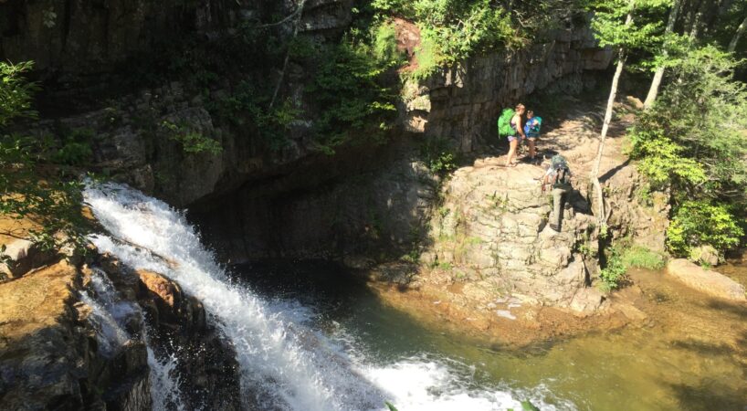
Once across the river, follow the well-beaten path, now with the river on your right. After about 0.2 miles, you’ll reach a large swimming hole, and another 0.2 miles later, you’ll arrive at the waterfall.
To return to the parking lot, simply retrace your steps.
Driving Directions
Follow US 11 north to Steeles Tavern. Turn right onto Route 56 towards Vesuvius. Just after crossing the South River (about a mile later), turn left onto South River Road, Route 608. Continue about 2 miles to the fork in the road and turn right to stay on Route 608.
Turn right onto Forest Service Road 41, St. Mary’s Wilderness Road. Continue about 1.5 miles to the parking lot and trailhead.
Insider's Tips
More to come!